


Valencia’s Lighthouses and the Stories Few People Know


For centuries, the Mediterranean coastline of the Valencian Community has been an important hub for trade, fishing and maritime travel. Trade routes ran along its shores, ships arrived from all corners of the Mediterranean, and port cities and small fishing villages flourished. However, the sea was not always kind to those who sailed it. Rocky headlands, underwater reefs, unpredictable weather and darkness created dangers even for the most experienced sailors.
This is why lighthouses were built: structures designed to help ships determine their position and navigate safely. Some have stood here for more than a century and a half, while others appeared much later, when the development of ports and maritime transport created a need for new navigational landmarks. Today, they can still be seen on rocky headlands, among coastal towns, on islands and even near modern port complexes.
How Lighthouses Changed Mediterranean Navigation
The history of navigational lighting goes back much further than most of the lighthouses that can be seen along the Spanish coast today. As far back as ancient times, sailors used bonfires on elevated ground to mark the approach to the shore or the entrances to ports. These signals had no sophisticated optical systems, but they could serve as important landmarks in the darkness.
During the Middle Ages, Mediterranean maritime trade expanded rapidly, bringing with it a growing need for more reliable navigational aids. Port cities established signal fires, built watchtowers and maintained systems for monitoring the sea. Some of these structures initially served a defensive purpose: they were used to watch for pirate and enemy ships and warn local communities of danger. Over time, some of these locations became the foundation for the development of navigational infrastructure.
The real expansion of Spain's lighthouse network took place in the 19th century. In 1847, a general plan for coastal and port lighting across the country was approved. It provided for the creation of a network of lighthouses with specific light characteristics, allowing sailors to identify particular stretches of coastline even in darkness. As a result, lighthouses were built at Cape San Antonio, Santa Pola, Cullera, Cape Oropesa and the Columbretes Islands. Their locations were determined by the shape of the coastline and the needs of maritime routes.
Technology also evolved. Initially, lighthouses used oil lamps, which were later replaced by kerosene and petroleum. The introduction of specialised lenses made it possible to concentrate light into a powerful beam visible over considerable distances. Later, lighthouses began to be electrified, and automated systems gradually replaced manual maintenance.
An important feature of lighthouses was that each had its own distinctive light pattern: a specific sequence of flashes, periods of illumination and intervals between them. This allowed sailors to distinguish between signals and identify which landmark was nearby.
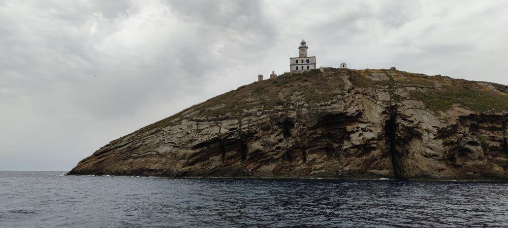
Lighthouses of Castellón: From Islands to Historic Coastal Towns
The northern part of the Valencian Community has a particularly interesting history of maritime navigation. Here, lighthouses that once guided ships near major ports stand alongside structures on remote islands, where keepers had to cope with long periods of isolation.
Columbretes Lighthouse: A Beacon in the Open Sea. Approximately 57 kilometres off the coast of Castellón lies the Columbretes archipelago, a group of small volcanic islands that are now protected as a natural park. Important maritime routes pass through these waters, making the establishment of a navigational landmark on the islands particularly significant.
Construction of the lighthouse on Illa Grossa began in 1856. It emitted its first signal in December 1859 and was officially inaugurated on 30 June 1860. The structure has a square base and a cylindrical tower approximately 21 metres high.
What made this lighthouse special was not only its distance from the mainland but also the living conditions of the people responsible for keeping it operational. For 116 years, lighthouse keepers and their families lived there permanently. They were responsible for the lighting, technical maintenance, fuel supplies and weather observations. Children were born on the island, families went about their daily lives there, and any need to travel to the mainland became a journey in itself.
In 1975, the lighthouse was automated, making the permanent presence of keepers unnecessary. Today, it remains operational and uses solar energy, among other power sources. Its premises have also taken on new functions related to scientific research and environmental education.
The Columbretes Islands can be visited on organised boat excursions from the mainland. As the archipelago is a protected natural area, access is regulated. This is not simply a casual trip to see a lighthouse: the journey requires advance planning and compliance with the natural park's visitor regulations.
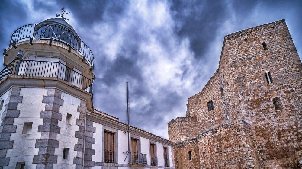
Peñíscola Lighthouse: Navigation Amid Medieval Architecture. In Peñíscola, maritime history is closely intertwined with the town's architecture. The town stands on a rocky peninsula crowned by a medieval castle, while its old streets descend towards the Mediterranean Sea.
Peñíscola Lighthouse began operating in 1899. It is located near Papa Luna Castle and the historic centre. The structure features an octagonal white tower approximately 11 metres high, attached to a two-storey building. Its history is linked to the development of maritime traffic along the northern coast of the province of Castellón. The rocky terrain and the town's location made clear navigational landmarks essential for vessels passing close to shore.
Today, the lighthouse forms part of the town's historic landscape. It can be seen while exploring the old town, combining the visit with a trip to the castle and a stroll through the narrow streets. The lighthouse building also houses an information centre, which, symbolically, continues to help visitors find their way.
Oropesa del Mar Lighthouse: A Landmark on a Rocky Coastline. Oropesa del Mar Lighthouse began operating in 1857. Its construction was part of the major expansion of Spain's Mediterranean coastal navigation system during the 19th century. It stands near Cape Oropesa, on a stretch of coastline where rocky outcrops alternate with sandy beaches. These geographical features made navigational lighting particularly important for ships travelling along the shore.
The lighthouse remains an active navigational facility today. Its light has a range of approximately 21 nautical miles. The surrounding area is also interesting from the perspective of coastal architecture: it offers an insight into how traditional maritime infrastructure has gradually become integrated into the modern tourist landscape.
Lighthouses of the Province of Valencia: The History of Ports and Coastal Settlements
In the central part of the Valencian Community, lighthouses tell the story of the development of major commercial ports, fishing villages and coastal towns. Here, it is particularly easy to see how navigational infrastructure evolved alongside maritime trade.
Valencia Lighthouse: From an Old Port Structure to Modern Technology. The history of navigational lighting in the port of Valencia began long before today's lighthouses appeared. As early as the 16th century, signal lights were used in the port area of El Grao to help ships navigate close to the shore.
The first known port light was installed in the western tower of an old defensive bastion, built by order of the city council in 1534. In 1829, it was moved to a new structure on the port breakwater. Later, during the 19th century, the port's expansion created a need for a more modern lighting system.
The old lighthouse in the port of Valencia witnessed several stages in the development of the city's maritime infrastructure. However, following the port's major expansion, its original location lost its practical importance. In June 2015, it permanently ceased operating as a navigational facility. Nevertheless, in July 2026, the city council and the Port Authority agreed to relocate the historic structure to the Marina de València area, where it will be more accessible to visitors. The project involves dismantling, restoring and reinstalling the structure while preserving its distinctive features.
The modern lighthouse that replaced the old structure was built in 2015. It is a technological installation made from fibreglass and carbon fibre. It uses renewable energy to power its navigational equipment, including solar panels and vertical-axis wind turbines.
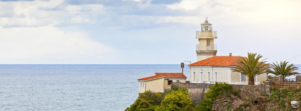
Cullera Lighthouse: More Than 160 Years of Maritime History. On the eastern side of Cape Cullera, near the town of the same name, stands one of the best-known historic lighthouses in the province of Valencia.
Its light was first switched on on 1 August 1858. The structure has a circular base, with a 16-metre-high conical stone tower rising from its centre. The focal plane of the light is located almost 28 metres above sea level.
The history of the lighthouse's technological development is particularly interesting. Initially, its lamp ran on olive oil, which was later replaced by paraffin and petroleum. In 1931, the lighthouse was electrified, marking an important step in the modernisation of the region's navigational infrastructure. Over the following decades, the lighting system was also upgraded while the building's overall architectural design was preserved.
Today, the lighthouse remains operational. It can be seen on a trip to Cape Cullera, where visitors can enjoy views of the Mediterranean Sea and the rocky coastline. The interior is closed to ordinary visitors for safety reasons, so the lighthouse can only be explored from the outside.
Canet d'en Berenguer Lighthouse: A Watchtower Turned Navigational Landmark. Canet d'en Berenguer Lighthouse has an interesting history rooted in coastal defence. As early as the 15th century, a watchtower stood on this site, where observers monitored the sea and warned of approaching pirate ships. It played an important role in protecting coastal settlements, which had suffered maritime attacks for centuries. Its height made it possible to monitor a considerable stretch of coastline and send warning signals when danger approached.
The present-day lighthouse was built in the early 20th century. It began operating in 1904 and became part of the navigational system serving maritime routes near the port of Sagunto.
Its most unusual feature is its location: the structure stands approximately 360 metres from the shoreline. This makes it an unusual landmark for those accustomed to seeing lighthouses directly on the water's edge or on rocky cliffs. The lighthouse is surrounded by modern buildings in Canet d'en Berenguer, close to residential neighbourhoods. It can therefore easily be included in a walk around the town, combined with a visit to the beach and an introduction to the area's maritime history.
Lighthouses of Alicante: Cliffs, Islands and Maritime Routes
The southern part of the Valencian Community has a more rugged coastline, with high headlands, coves and islands. Here, lighthouses are often located high above sea level, and their beams helped ships navigate around dangerous stretches of coastline.
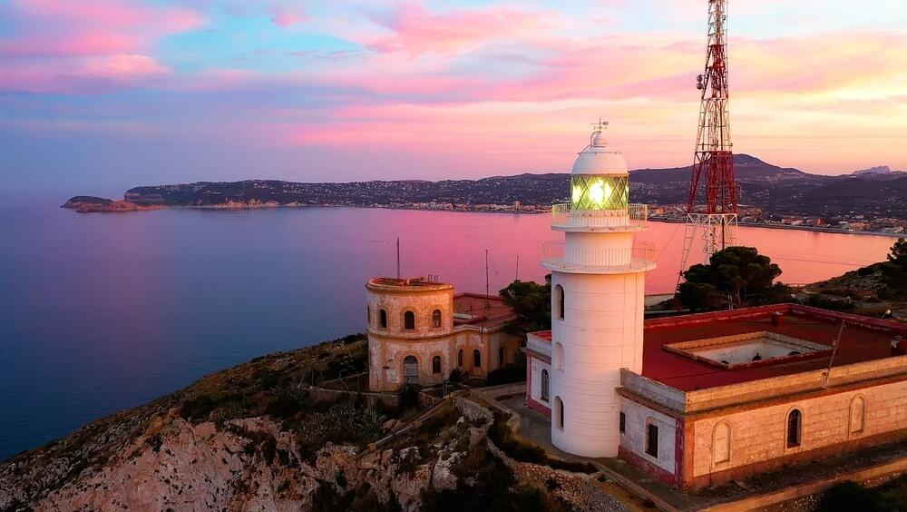
Cape San Antonio Lighthouse: Above the Mediterranean. Between the towns of Jávea and Dénia lies Montgó Natural Park, which includes Cape San Antonio. This is one of the most striking natural landmarks on the Alicante coast, where towering cliffs plunge steeply into the sea.
The first lighthouse on the cape began operating in 1855, while the present structure took on its navigational role in 1861. It stands approximately 160–170 metres above sea level, giving its light a considerable range.
The location was chosen for a reason. Cape San Antonio is an important geographical landmark on the eastern coast of the Iberian Peninsula. It is also one of the points on mainland Spain closest to Ibiza.
Today, the area around the lighthouse is particularly appealing for its natural scenery. From the viewing platforms, visitors can see Jávea Bay and, in favourable weather, even make out the outlines of the Balearic Islands.
Cape Santa Pola Lighthouse: The Legacy of an Old Watchtower. Santa Pola Lighthouse has particularly interesting historical origins. It stands on the site of the former Atalayola watchtower, built in the 16th century to monitor the sea.
These towers were part of a coastal defence system designed to protect settlements from pirate attacks and warn of impending danger. Their elevated position made it possible to keep watch over the sea and transmit signals to neighbouring fortifications.
In 1858, a lighthouse was established on this site to help ships navigate the waters around Santa Pola Bay. Its light is positioned approximately 152 metres above sea level.
Today, the lighthouse is interesting not only for its history but also for the surrounding landscape. Viewing platforms and walking paths offer panoramic views of Santa Pola Bay, Alicante and Tabarca Island.
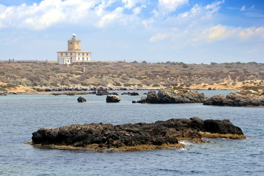
Tabarca Lighthouse: The History of an Island and Safe Navigation. Tabarca Island, located near Santa Pola, has a distinctive maritime history. For centuries, its rocky shores and underwater obstacles made it difficult for ships to approach the island.
In the 18th century, the island began to be settled by Genoese fishermen who had been relocated there from the Tunisian island of Tabarka. A fortified settlement subsequently developed, and the growth of fishing and maritime connections increased the need for a reliable navigation system.
Tabarca Lighthouse was built in the mid-19th century, with construction completed in 1854. The building has a rectangular layout and was originally designed not only as a navigational facility but also as a place for scientific and educational activities. This was a fairly progressive concept for its time. The lighthouse was intended to ensure safe navigation, while its premises could be used by specialists working in maritime-related fields.
Today, Tabarca is best known as a protected natural area featuring a marine reserve, crystal-clear waters and a rich underwater ecosystem. The lighthouse remains part of the island's historic landscape, although its interior is not a regular tourist attraction.
The arrival of satellite navigation, radar systems and digital maps has significantly changed maritime travel. Modern vessels have access to technologies that allow them to determine their coordinates with great accuracy, meaning that lighthouses are no longer the only way to navigate at sea.
However, this does not mean they have lost their importance. Light signals remain an essential part of maritime safety systems, particularly near ports, headlands, islands and difficult stretches of coastline. They provide an additional visual reference and help sailors check that they are following the correct route.
The way these structures are maintained is also changing. Automation has made it possible to eliminate the need for permanent lighthouse keepers in most facilities. Solar panels and other renewable energy sources help ensure that equipment can operate independently in remote locations.
Some historic lighthouses have taken on new cultural roles. Their buildings are now used as tourist information centres, museums, exhibition spaces or scientific research facilities. This helps preserve maritime heritage and introduce it to new generations.
The lighthouses of the Valencian Community illustrate this transition particularly well, from purely practical navigational infrastructure to an important part of the cultural landscape. Each structure has its own story: the development of ports, the struggle against maritime dangers, the lives of lighthouse keepers on remote islands or technological changes in seafaring.


ABOUT Torodoro
FOR BUSINESS
FIND US ON SOCIAL

