


Whitewashed Villages and Ancient Trails of Andalusia


In southern Spain, nestled on mountain slopes, villages have survived where narrow streets, whitewashed houses and ancient mountain paths tell the story of Andalusia just as vividly as museum exhibitions. In the Alpujarra region, old roads still connect settlements that merchants, farmers and travellers have passed through for centuries. Walking these routes offers a glimpse into how people adapted to mountain life and how the Arab-Andalusian heritage influenced local architecture, agriculture and traditions.
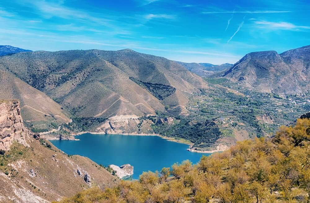
The Alpujarra stretches along the southern slopes of the Sierra Nevada across the provinces of Granada and Almería. Its landscape is shaped by deep ravines, terraced hillsides, chestnut groves and small settlements located at different elevations. For centuries, agriculture, crafts and trade flourished here, while the mountainous terrain determined where houses were built and which routes people used to travel between villages.
The region's history is closely linked to Al-Andalus, the name given to the territories of the Iberian Peninsula that were under Muslim rule after the conquest of much of the peninsula in the early 8th century. Over the following centuries, agriculture, crafts and trade developed here, while Arab and Berber settlers introduced new architectural traditions and improved irrigation systems. In the mountainous Alpujarra, these influences are particularly evident in the network of irrigation channels, terraced fields and distinctive village layouts adapted to steep slopes.
After the Christian conquest of the Emirate of Granada in 1492, the local Muslim population was initially guaranteed the right to preserve its religion and customs. However, over time, it faced increasingly intense pressure to convert to Christianity by force. The Morisco uprising in the 16th century, its suppression and the subsequent expulsion of a significant proportion of this population brought profound demographic and cultural changes. At the same time, some inherited agricultural practices, particularly irrigation systems and methods of cultivating mountain land, continued to be used after these events.
Today, the Alpujarra's heritage can be seen in the layout of its villages, irrigation systems, agricultural terraces and old roads winding between mountain slopes. These features make the region appealing not only to nature lovers but also to those who want to gain a deeper understanding of Andalusia's history.
Pampaneira, Bubión and Capileira: Three Villages Above the Poqueira Gorge
One of the region's most striking historic landscapes is the Poqueira Gorge, where Pampaneira, Bubión and Capileira are perched on mountain slopes. These three villages have preserved the characteristic architecture of the Alpujarra and their shared historical connection with the surrounding farmland. In 1982, their historic centres were designated Historic-Artistic Sites.
Pampaneira, located in the lower part of the gorge, attracts visitors with its narrow streets, craft workshops and traditional houses. Here, you can find local textiles, rugs and other products made using age-old craft techniques. The village centre, with its small squares and network of winding alleyways, is ideal for a leisurely stroll before setting off on a hiking route.
Higher up lies Bubión, where traditional buildings demonstrate particularly clearly how architecture has adapted to the mountainous terrain. Flat-roofed houses, narrow passageways and terraces form a compact settlement typical of many historic villages in the Alpujarra. The local ethnographic museum, housed in a traditional building, offers an insight into the everyday lives of the region's inhabitants, from the arrangement of their homes to their agricultural work.
Capileira lies even higher, on the slope overlooking the gorge, with views across the valley and towards the high peaks of the Sierra Nevada. It is one of the most convenient starting points for hikes into the surrounding mountains. In the village itself, it is worth paying attention to the traditional houses, old streets and viewpoints, which offer a clear picture of how the buildings fit into the steep terrain.
In these three villages, the appeal lies not simply in walking from one square to another, but also in observing how the landscape changes. The higher the road climbs, the more clearly the mountain slopes, terraced fields and the Poqueira River flowing along the bottom of the gorge come into view.
The Old Royal Road Through the Poqueira Gorge
One of the best ways to explore the historic landscape of the Alpujarra is to follow the Pueblos del Poqueira route, which connects Pampaneira, Bubión and Capileira. Some sections follow old roads that residents used to travel between settlements long before the modern road network was established.
The PR-A 70 route passes through agricultural terraces, crosses old footpaths and runs alongside sections of traditional irrigation channels known as acequias. Many of these channels are associated with irrigation systems developed during the Muslim period and were used to distribute water between fields and orchards. Thanks to them, even steep mountain slopes could be used for growing crops.
Along the way, visitors will encounter fruit trees, chestnuts, the remains of old agricultural buildings and stone crossings. All these features serve as a reminder that mountain paths were not merely walking trails, but also part of the region's everyday infrastructure. People used them to reach their fields, transport harvests, visit neighbouring villages and maintain trade links.
The full Pueblos del Poqueira route is usually completed as a circular hike and takes several hours. The exact distance and duration depend on the chosen variation, as local tourist services provide different figures for the various route options. Before setting off, it is worth checking the latest information on trail conditions, elevation changes and any restrictions.
Those who are not planning a long hike can walk just part of the old road between neighbouring villages. This shorter walk offers a chance to see the traditional architecture and surrounding terraces without having to complete the entire circular route.

Further east lies Trevélez, one of the Alpujarra's best-known mountain villages. Situated at approximately 1,500–1,600 metres above sea level, it is famous for its cured ham. Its high-altitude location provides cooler conditions than those found in the lowlands of Andalusia, while the dry air and natural air circulation in the mountains help create favourable conditions for the traditional curing process. During the lengthy curing period, the ham gradually loses moisture and develops its characteristic flavour, aroma and texture. It is this combination of local climatic conditions and traditional production methods that has made Trevélez one of Spain's best-known centres of ham production.
The village consists of several districts located at different elevations. This layout reflects the settlement's adaptation to the mountainous terrain and offers varied views of the Trevélez River valley and the surrounding slopes. A walk through its historic streets reveals traditional houses, small squares and local establishments where visitors can sample dishes from the Alpujarra, such as plato alpujarreño, a hearty dish of potatoes, fried eggs, cured ham, sausage and morcilla, a traditional blood sausage, or migas, fried breadcrumbs served with a variety of accompaniments, including meat products, peppers or grapes. The local cuisine reflects the region's rural culinary traditions, where simple ingredients and hearty meals have been part of everyday life for centuries.
The surroundings of Trevélez are particularly appealing to those who want to continue exploring historic mountain routes beyond the villages themselves. Trails from here lead into the high mountain areas of the Sierra Nevada, including Siete Lagunas and the Mulhacén massif. However, these hikes are considerably more demanding than walks between villages: they involve substantial elevation gains, long periods in exposed terrain and careful preparation.
There is no need to head for the highest peaks to appreciate the historical importance of the local routes. The old roads around Trevélez and neighbouring settlements help visitors understand how mountain communities made use of pastures, water resources and natural passes between valleys.
Sulayr: The Route Around the Sierra Nevada
For those who want to extend their journey beyond a single village or gorge, there is Sulayr (Sulayr GR-240), a circular hiking trail around the Sierra Nevada massif. It covers approximately 300 kilometres, with individual stages crossing a variety of mountain landscapes, forests, old agricultural land and areas where natural resources have traditionally been used.
The name Sulayr comes from an Arabic expression associated with the image of the mountain of the sun. The route offers an opportunity to explore different sides of the mountain range and trace the connections between the natural environment and the settlements that developed along its slopes.
Unlike the shorter routes between villages, Sulayr is designed for multi-day hikes. It is divided into stages that can be completed separately, allowing hikers to choose a suitable distance and level of difficulty. One option is accessible near Capileira: from there, the trail heads towards Puente Palo, passing through areas of former agricultural land, alongside historic irrigation channels and through natural forests.
This route is particularly interesting because it combines natural and cultural heritage. The trail passes through places where people once cultivated the land, built water management systems and established paths connecting remote communities. The remains of agricultural buildings and ancient channels reveal just how closely local life was linked to the terrain and access to water.
At the same time, Sulayr should not be treated as one long weekend walk. Completing the full route requires planning overnight stays, checking water availability and assessing the difficulty of each stage in advance. If the aim is simply to explore historic roads without undertaking a lengthy trek, choosing a single section near a village is enough.
Architecture That Tells the Story of Mountain Life
The historic villages of the Alpujarra are interesting not only because of their locations but also because of their distinctive traditional architecture. Their houses are adapted to steep slopes and the local climate. Many buildings have flat roofs covered with a traditional material called launa, a type of clay-rich rock that helps protect buildings from rainfall.
Another characteristic feature is the tinao: a covered passageway or small gallery connecting parts of buildings and creating shaded walkways beneath upper floors. Together with narrow streets, whitewashed walls and houses arranged along terraced slopes, these features create an architectural style that makes many villages in the region instantly recognisable.
Behind this architecture lies the practical experience of generations. Houses were built using locally available materials and taking into account the terrain and the needs of agriculture. Narrow passageways helped organise buildings within limited spaces, while terraces around the villages made it possible to cultivate crops on the slopes.
The acequias, irrigation channels that distributed water between plots of land, were equally important. They influenced the location of fields, orchards and agricultural buildings, while also requiring regular maintenance and cooperation among residents. This is why walking along the old roads reveals not just individual historic landmarks, but an entire system that sustained mountain communities.
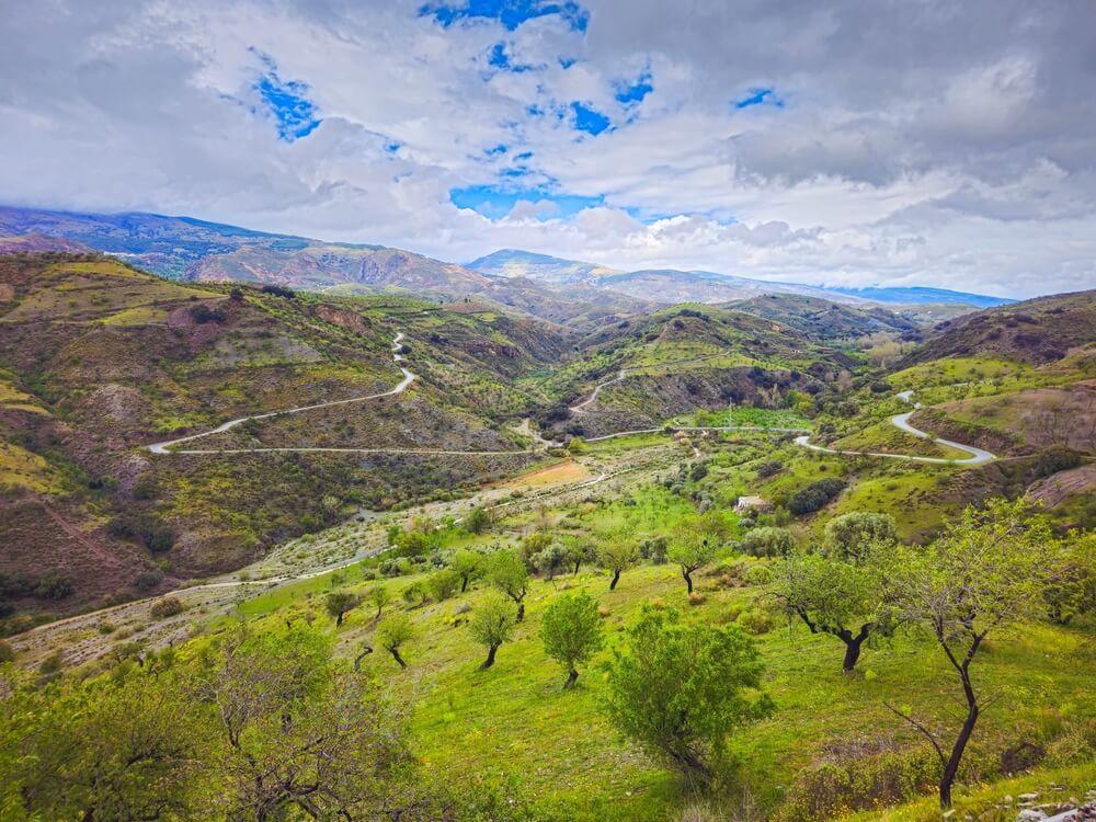
The Alpujarra is worth visiting at any time of year, but hiking conditions vary considerably depending on altitude and weather. In spring, the slopes turn green, and walks between villages offer views of agricultural terraces and orchards. In autumn, chestnut groves and deciduous forests become particularly attractive as their leaves change colour. It is an excellent time to explore the lower and middle elevations, although rain can make rocky sections slippery.
In summer, it is best to plan walks for the early morning and bear in mind that exposed slopes can become hot even in the mountains. In winter, high-altitude areas may experience snow, ice and strong winds, meaning that routes accessible to ordinary hikers during the warmer months may require specialist equipment and experience.
Before setting out, it is worth checking the latest trail conditions, the weather forecast and information provided by the natural park authorities. Appropriate footwear, an adequate supply of water and enough time to return are also essential. In the mountains, distance alone does not always indicate how difficult a route will be: a significant elevation change can make a short walk far more exhausting than expected.
When planning a trip, visitors can combine walks along old roads with visits to historic centres, local craft workshops and traditional eateries. This approach offers a chance to discover the Alpujarra not merely as a natural landscape, but as a region with its own history, culture and living traditions.


ABOUT Torodoro
FOR BUSINESS
FIND US ON SOCIAL
AVAILABLE LANGUAGES

